How to find out how many people live in Lower Hutt
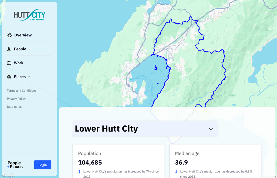
If you're interested about how Lower Hutt city has changed since 2006, you should take some time to explore the People+Places webapp. Unfortunately, the data from the 2023 census hasn't been incorporated (yet?), but it's much nicer to use than the tools that are provided by officials.
How many people live in Lower Hutt?
Lower Hutt's population in 2023 is estimated to be 111,500.
This figure is generated through statistical analysis by Stats NZ, taking into account migration rates as well as births and deaths. Stats NZ provides estimates of what the population is likely be today as well as forecasts for what the population is likely to be in the future.
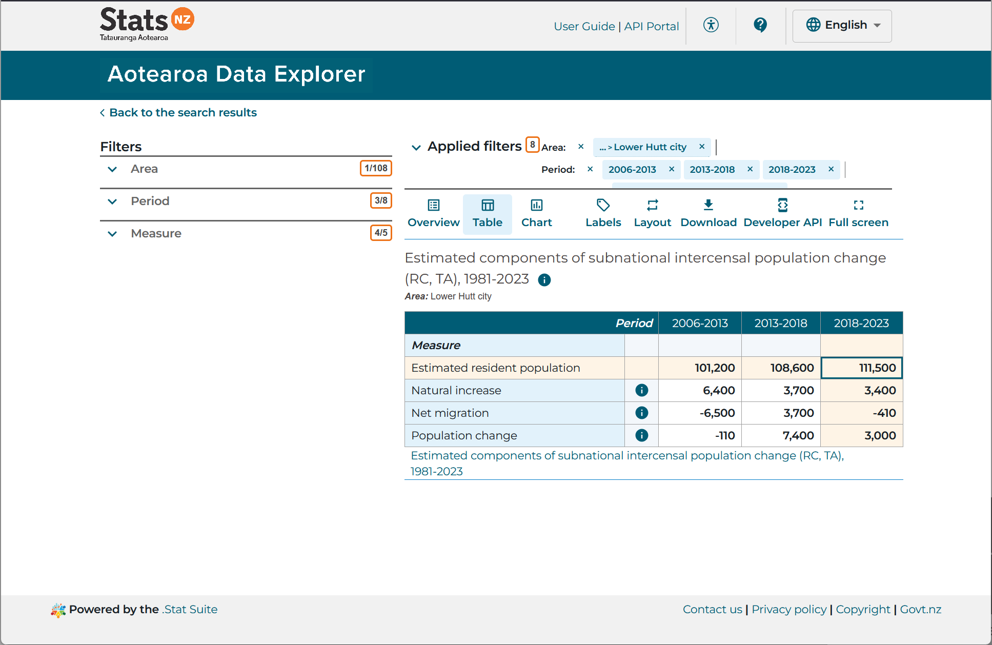
Here is an output of the Aotearoa Data Explorer webapp showing Lower Hutt city's population increase at the end of 2013 (101,200) to 2023 (115,500)
How fast has Lower Hutt's population grown?
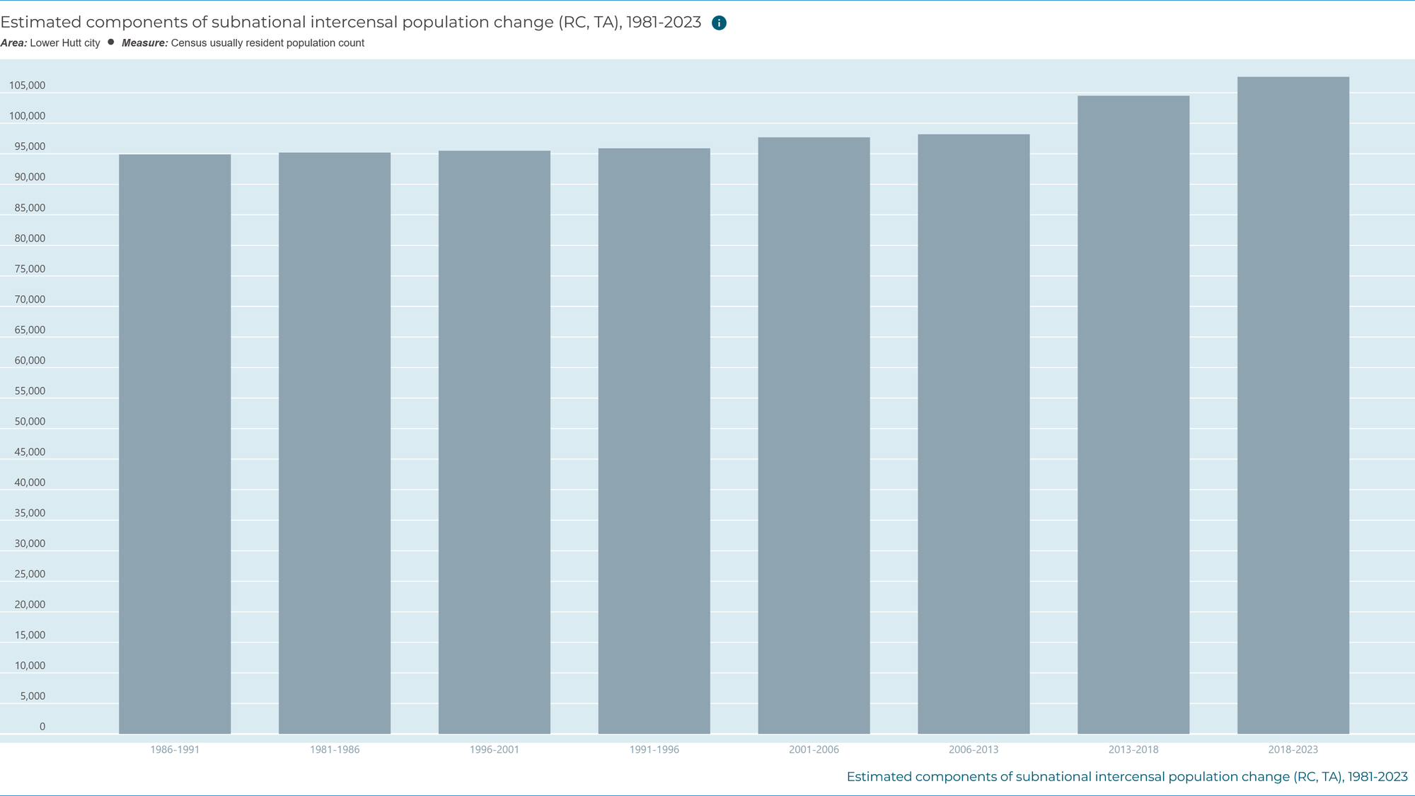
You can use the Aotearoa Data Explorer to track the estimates of the city's population all the way back to 1991, or 1981 if you wish to stick with census figures only. You can see that the city's population growth has been much faster since 2006 than in the previous 3 decades. This explains – at least to some degree – why there's a strain on infrastructure.
How have Lower Hutt's suburbs changed between 2013 and 2023?
For a rough equivalent of the People+Places view that includes 2023 data, look f0r the 2023 Census maps and data webapp, specifically the "2023 Census population change" map.
To get to the view below, click through to the map and wait for it to load, then click on Statistical area 2 (which roughly means suburb) and zoom in to Lower Hutt. I have also opened the legend, which you can toggle by clicking Legend menu item on the left-hand side of the page.
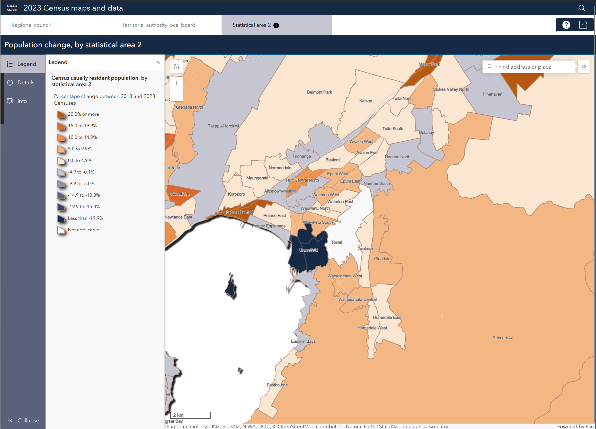
Which of Lower Hutt's suburbs have had population growth?
Petone's population towards western end of the beach (Petone Central) grew to 1,182, up from 909 in 2013. That's a 30% increase in 10 years.
The suburbs of Hutt Central, Epuni, Waterloo and Waiwhetu have also had population increases over the same period.
Which of Lower Hutt's suburbs have had population decreases?
Gracefield stands out most prominently, with over a 20% decrease in population between 2013 and 2023.
Older, more established areas, including Petone esplanade, Alicetown, the Eastern Bays and Woburn have also population decreases, albeit far slighter. I suspect that many younger people are being priced out of these areas, meaning that the suburbs cannot sustain their populations.
Hilly areas of Naenae and Stokes Valley (the Delaney are) have had population decreases also. It'll be interesting to look into what the drivers there are, because they won't be the same as the drivers in the more affluent areas mentioned in the previous paragraph.
How to dig deeper
The authoritative source of demographic information in New Zealand is provided by Stats NZ through its administration of the 5-yearly census. The latest census was held in 2023. Information gathered from the census are provided in a few formats via the Aotearoa Data Explorer, a maps and data webapp and information releases.
Where are the datasets?
If you're a data geek, then you can access the underlying datasets for free. Maybe you could build an updated People+Places map!
- Dataset: 2023 Census population change by SA2 (Web Feature Service, Shapefile + other geo formats)
- Service: Infoshare provides population estimates and forecasts from June 1991 to June 2024